
INTERGEO 2026: GeoAI, Digital Twins and Reality Capture Mark a New Phase for the Geospatial Industry
INTERGEO 2026, held in Munich from 15 to 17 September, highlighted a significant transformation in the geospatial industry: the transition from standalone technologies to increasingly integrated sy
Latest from World
Call for articles - GEOmedia magazine 2027 Editorial Programme
GEOmedia è la prima rivista italiana di geomatica a carattere scientifico-divulgativo. Da 30 anni pubblica argomenti collegati alle tecnologie dei processi
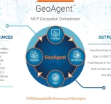
From AI Pilots to Operational GeoAI: How Agentic AI Is Transforming Geospatial Workflows
An interview with NV5's Principal AI Architect Chancee Vincent highlights a critical transition in geospatial intelligence: moving beyond isolated AI models towards integrated, human-supervised wor
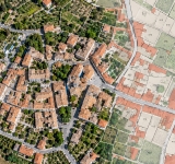
Embracing modern aerial technologies to enhance accuracy in Italy
The Italian Revenue Agency’s experimentation with drone-based photogrammetry brings a practical question into focus: how can aerial surveying support the quality and updating of cadastral maps? T

INTERGEO 2026: GeoAI, Digital Twins and Reality Capture Mark a New Phase for the Geospatial Industry
INTERGEO 2026, held in Munich from 15 to 17 September, highlighted a significant transformation in the geospatial industry: the transition from standalone technologies to increasingly integrated sy
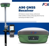
FOIF GNSS and Total Station: One Integrated Surveying Workflow with FoifPad 4.2
From satellite positioning to total station measurements, vidaLaser presents an integrated solution combining the FOIF A90 GNSS receiver, RTS102R6 total station and FoifPad 4.2 software in a single

Geo Week 2027 Conference Program and Speaker Roster Announced
Sessions tackle AI realities, subsurface mapping, resilient infrastructure, workforce challenges and more, plus new Digital Insider Access option.
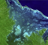
FAO’s SEPAL: Satellite Technology for Smarter Forest Monitoring
Satellite Earth observation, radar technologies and cloud-based geospatial platforms are transforming forest monitoring worldwide. FAO's SEPAL
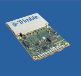
Trimble Introduces Next-Generation GNSS Performance with New Receivers and Enhanced Technology
GNSS receivers employ new technology to deliver comprehensive anti-jamming and anti-spoofing capabilities, better performance and future-ready support for low-earth orbit constellations to OEM inte
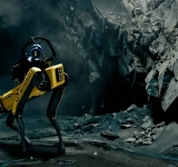
Emesent Secures $2M Grant to Develop GPS-Denied Autonomy Platform Cortex AI
Emesent, an autonomous mapping and robotics company, has been awarded a $2 million USD grant from the Australian Government’s Cooperative Research Centres Projects (CRC-P) program to develop and

Reality Capture Is Changing: From LiDAR and SLAM to Intelligent 3D Mapping
Ahead of INTERGEO 2026 in Munich, reality capture is emerging as one of the most dynamic areas of the geospatial industry. LiDAR, SLAM, imaging and AI are converging into increasingly integ
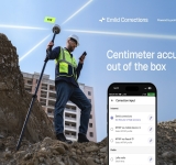
Emlid builds RTK corrections into its wide range of Reach receivers, with a free 1-year license for new and existing users
Emlid Reach receivers now come with built-in RTK corrections powered by the Point One Navigation network, making centimeter-accurate surveying possible right out of the box. 1 year of Emlid Correct

International Journal of Cartography – Volume 12, Issue 3 (2026) Published Online
The International Cartographic Association (ICA) has announced the online publication of Volume 12, Issue 3 (2026) of the International Journal of Cartography, featuring new peer-r

Esri Reflects on Five Years of Simplifying the ArcGIS Platform
Esri has published a retrospective outlining how ArcGIS has evolved over the past five years, highlighting a continuous effort to simplify user experience, licensing, application development and sp

HERE Technologies and Esri partner to develop location analytics to support AI adoption
HERE Technologies, the world’s leading mapping and location data company, and Esri today announced a 3-year agreement to jointly develop location-based analytics and visualization solutions that
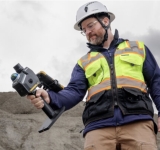
Topcon and GreenValley International collaborate on spatial intelligence innovations
LIVERMORE, Calif. — July 14, 2026 — Topcon Positioning Systems announced it has entered a strategic agreement with GreenValley International(GVI) to collaborate on technologi