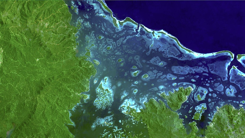
Satellite Earth observation, radar technologies and cloud-based geospatial platforms are transforming forest monitoring worldwide. FAO's SEPAL initiative demonstrates how accessible satellite data can strengthen forest protection, environmental governance and climate action.
Satellites at the forefront of forest protection
Satellite Earth observation is becoming an essential component of environmental monitoring, providing governments, researchers and local communities with increasingly sophisticated tools to assess forest conditions, detect deforestation and evaluate ecosystem restoration. In a recent article published by the Food and Agriculture Organization of the United Nations (FAO), Monitoring forests from space: a new era of forest monitoring and protection, Julian Fox, FAO Senior Forestry Officer, highlights how satellite technologies are reshaping the way countries observe and manage their forest resources.
According to figures reported by FAO, approximately 10.9 million hectares of forest are lost annually through deforestation. Although natural regeneration and reforestation compensate for part of these losses, the global net reduction remains close to four million hectares per year. These figures underline the importance of reliable, continuous and transparent monitoring systems capable of translating satellite observations into actionable information.
SEPAL: making satellite data accessible
One of the most significant developments in this field is SEPAL – System for Earth Observation Data Access, Processing and Analysis for Land Monitoring, an open-source platform developed through FAO's Open Foris initiative. Accessible through sepal.io, SEPAL provides a cloud-based environment in which users can access, process and analyse satellite imagery without requiring extensive local computing infrastructure.
The platform combines Earth observation datasets with geospatial processing capabilities, supporting applications such as forest-cover mapping, land-use change detection, deforestation assessment and ecosystem restoration monitoring. Its significance extends beyond technological performance. By reducing barriers to advanced geospatial analysis, SEPAL enables national institutions and technical practitioners to develop monitoring workflows and strengthen their capacity to produce reliable environmental information. This approach is particularly relevant for countries where access to specialised software, high-performance computing resources and technical expertise remains limited.
Radar observations and the challenge of tropical forests
A central issue in forest monitoring is the persistence of cloud cover, especially in tropical regions where conventional optical satellite imagery may be unavailable for extended periods. Synthetic Aperture Radar (SAR) offers an important complementary observation capability because radar sensors can acquire information independently of daylight and through cloud cover.
As highlighted in the FAO article, cooperation with the Japan Aerospace Exploration Agency (JAXA) is strengthening the integration of radar Earth observation data into forest monitoring systems. In particular, observations from the ALOS-2 satellite can contribute to identifying forest disturbances in regions where optical monitoring is frequently constrained by atmospheric conditions.
The combination of optical and radar imagery, supported by cloud-based processing environments, creates opportunities for more consistent monitoring of forests, mangroves, peatlands and other environmentally sensitive ecosystems. Nevertheless, satellite-derived information still requires appropriate interpretation, validation and integration with field observations to ensure the reliability of monitoring results.
From geospatial data to environmental accountability
The increasing availability of satellite observations is also changing the relationship between environmental monitoring and public policy. Forest information is essential for national greenhouse gas inventories, climate commitments, biodiversity conservation strategies and international reporting mechanisms.
Platforms such as SEPAL can support the development of Measurement, Reporting and Verification (MRV) systems, helping institutions document changes in forest extent and land use through transparent and reproducible geospatial methodologies.
In June 2026, FAO announced a new contribution of approximately USD 9.5 million from Norway to support the third phase of SEPAL through 2030. The programme aims to strengthen national forest monitoring capabilities, technical independence and the application of geospatial information to climate action. At that time, FAO reported more than 30,000 active SEPAL users across 205 countries and territories, illustrating the international relevance of accessible Earth observation infrastructure.
The next challenge: turning observation into action
The evolution of forest monitoring demonstrates how the integration of satellite missions, cloud computing, open-source technologies and geospatial analytics can make environmental information more widely available. However, monitoring alone cannot stop deforestation. The real value of Earth observation emerges when reliable geospatial information becomes part of operational decision-making, supporting timely interventions, restoration programmes, territorial planning and sustainable resource management.
For the geomatics and Earth observation community, initiatives such as SEPAL provide a concrete example of how technological innovation can be connected with institutional capacity building and environmental governance. The challenge is no longer simply observing environmental change, but ensuring that the information collected from space leads to effective action on the ground.
Sources and further reading
FAO – Monitoring forests from space: a new era of forest monitoring and protection
Read the original FAO article
SEPAL – System for Earth Observation Data Access, Processing and Analysis for Land Monitoring
Visit the SEPAL platform
FAO – Norway and FAO scale up forest monitoring for climate action
Read the FAO announcement