
Questa settimana Earth from Space presenta un'immagine invernale: una sfera bianca e rossa, che - se vista da lontano - ricorda una decorazione festosa.
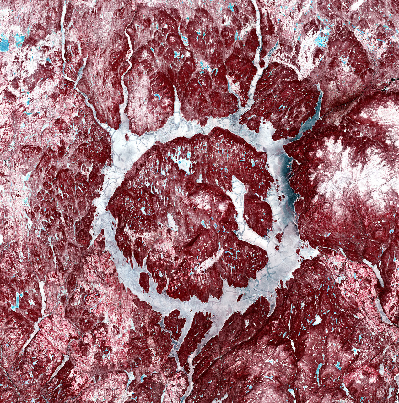
La 'pallina' in questione è in realtà il cratere Manicouagan, che si trova nella provincia canadese del Quebec. Visibile dallo spazio, questa struttura rotonda si è formata a seguito dell'impatto di un gigantesco asteroide avvenuto circa 214 milioni di anni fa.
Il bacino anulare, con l'isola René-Levasseur al centro, si trova a circa 700 km a nord-est di Quebec City. A volte chiamato 'occhio del Quebec', si estende per 72 km da est ad ovest e si ritiene che l'asteroide che causò l'impatto avesse un diametro di 5 km.
Il bacino, noto anche come lago Manicouagan, fu creato negli anni '60 come parte di un progetto idroelettrico, che aveva l’obiettivo di fornire energia elettrica in tutta la provincia. Il fiume Manicouagan è visibile in basso nell'inquadratura mentre fuoriesce dal bacino.
Questa immagine a falsi colori è stata acquisita da Copernicus Sentinel-2. Gli strumenti a bordo dei satelliti Sentinel-2 sono sensori per immagini multispettrali, ad alta risoluzione, con 13 bande spettrali. Forniscono immagini ad alta risoluzione spaziale entro 10 m.
In questa immagine il bianco è in realtà neve. L'acqua ghiacciata del lago – visibile ingrandendo l’immagine, in particolare sull'isola René-Levasseur – è mostrata in blu. La fitta vegetazione dell'area, che appare in rosso, comprende foreste boreali e tundra, che fanno parte di una riserva di biosfera designata dall'UNESCO.
Scarica immagine Hi-Res (30,47 MB - .JPG)
Scarica immagine Hi-Res (582,01 MB - .TIF)
---
Manicouagan crater
This week Earth from Space features a wintery image: a red and white sphere that, if seen from a distance, resembles a festive decoration.
The ‘bauble’ in question is actually the Manicouagan crater in the Canadian province of Quebec. Visible from space, this round structure was formed by a giant asteroid impact some 214 million years ago.
The anular reservoir, with René-Levasseur Island at its centre, is some 700 km north-east of Quebec City. Sometimes referred to as the ‘eye of Quebec’, it spans 72 km from east to west, while the asteroid that caused the impact is thought to have been 5 km in diameter.
The reservoir, also known as Manicouagan lake, was created in the 1960s as part of a hydroelectric project to provide hydropower across the province. The Manicouagan river is visible at the bottom of the image as it leaves the reservoir.
This false-colour image was captured by Copernicus Sentinel-2. The instruments on board the Sentinel-2 satellites are high-resolution multispectral imagers with 13 spectral bands. They provide high-resolution images to within 10 m.
In this image, the white is actually snow. Frozen lake water – visible across the image if you zoom in, particularly on René-Levasseur Island – is shown in blue. The area’s thick vegetation, shown in red, includes boreal forest and tundra that are part of a UNESCO-designated biosphere reserve.
[Credits: contains modified Copernicus Sentinel data (2022), processed by ESA - Translation: Gianluca Pititto]
