Artificial intelligence and Digital Twins are increasingly central to the geospatial industry, but adding AI to a workflow or displaying a city in 3D does not automatically make either one useful.
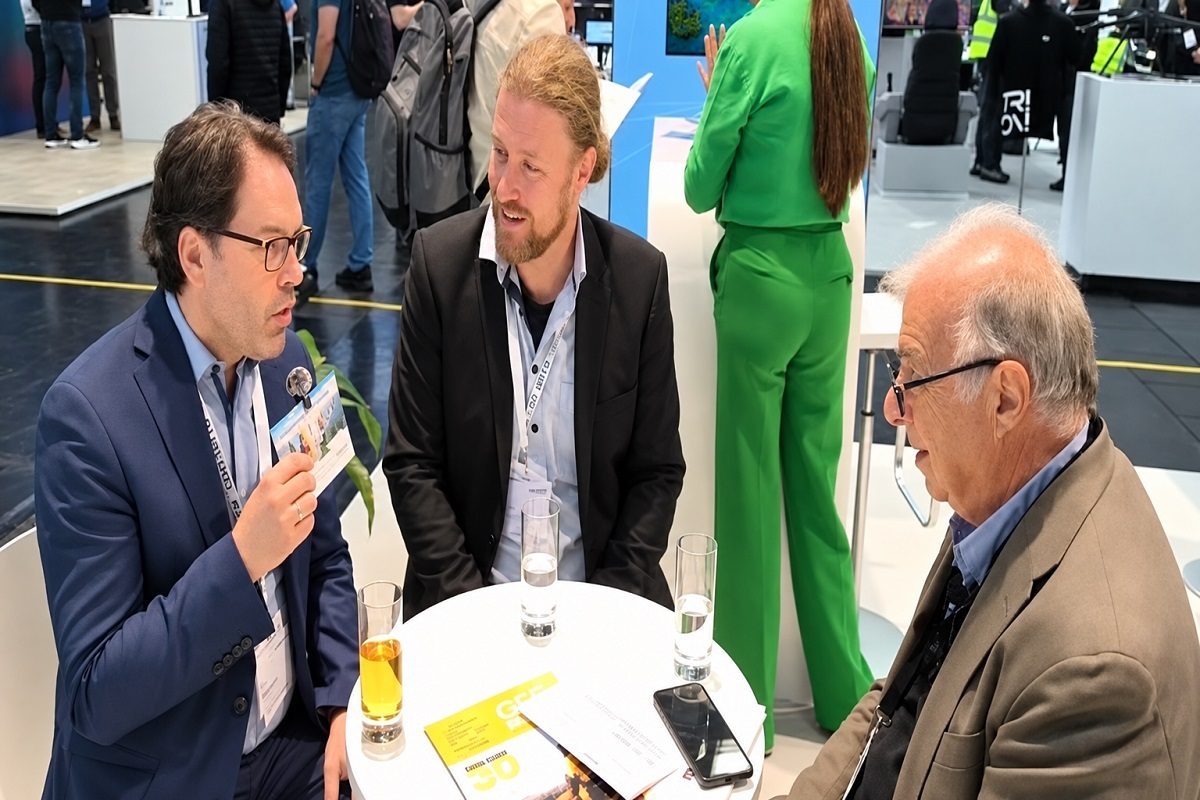
At INTERGEO 2026, GEOmedia spoke with Toro Fechner, Director of Business Development and Consulting at CON TERRA, and Mark Lehmann, working in Business Development with a focus on AI and Digital Twin topics. The conversation explored useful GeoAI, human-in-the-loop automation, accessible Digital Twins and the distributed responsibility required to keep geospatial information alive over time.
The perspective presented by CON TERRA shifts attention away from technology for its own sake and towards specific user problems.
AI becomes valuable when it removes a genuine bottleneck, supports a task that was previously difficult to scale or makes geospatial information accessible to new categories of users. A Digital Twin, meanwhile, is not defined simply by whether it is presented in 2D or 3D, but by how information, applications and tools are organized around particular users and requirements.
A further issue emerges when these systems need to remain current over time: rather than relying on one centralized Digital Twin, CON TERRA points towards a federation of interconnected Digital Twins, maintained by the organizations that understand and own the relevant domains.
Renzo Carlucci, GEOmedia: I am Renzo Carlucci, Editor-in-Chief of GEOmedia magazine. Today we are with CON TERRA to discuss GeoAI and Digital Twins. Could you introduce yourselves?
Toro Fechner, CON TERRA: I am Toro Fechner, Director of Business Development and Consulting at CON TERRA. My colleague Mark Lehmann also works in Business Development, with a particular focus on AI and Digital Twin topics.
GEOmedia: When does GeoAI become genuinely useful rather than simply adding AI to an existing geospatial workflow?
Toro Fechner: GeoAI becomes genuinely useful when you consider the additional capabilities it provides—things that you can now do which you could not do before, or tasks that can be performed much more effectively.
One example concerns metadata.
With geodata, we need to create metadata, and traditionally this has been a human task. Someone needs to examine a dataset, describe it, give it a title and abstract, and maintain that information over time as the data is published and used by different parties.
We have seen over many years, including through INSPIRE-related processes, that metadata maintenance is not necessarily a task that users enjoy performing.
AI can help here.
It can suggest how the data should be described. It can propose improvements to the title or abstract and even identify potential flaws or errors in the metadata.
A large language model can analyse the data and provide suggestions to the human operator, who can then accept, edit or reject them.
That is a process where a substantial part of the work can be automated while still maintaining human review.
Mark Lehmann, CON TERRA: We do not believe in simply throwing an entire process into AI.
Instead, we focus on individual steps within a process where AI can solve a specific problem that is currently difficult or time-consuming for administrators and users.
Metadata management is a good example.
AI could generate proposals automatically—overnight, for instance—and then a human remains in the loop to review and accept the new proposals.
But there are also other possibilities.
Natural-language interaction can help us reach new categories of users. For example, people can potentially talk to a Digital Twin rather than having to understand the traditional interfaces of a geospatial portal.
AI can also help translate what is contained in a Digital Twin for people who have limitations in accessing conventional geospatial interfaces.
One example is improving access for blind users. Traditional geodata portals are not necessarily the easiest way for these users to interact with geographic information. AI and natural-language interfaces can offer new ways of making that information accessible.
GEOmedia: What makes a Digital Twin different from a 3D representation of the real world? This is a particularly relevant question today because so many people are discussing Digital Twins.
Toro Fechner: In essence, a Digital Twin does not necessarily care whether its representation is 2D or 3D.
But 3D can make geospatial information more accessible to non-specialist users who may not be familiar with geodata.
With a traditional 2D map, you need a certain level of training to understand and interpret what is being shown.
You have the concept of layers that can be superimposed. You can turn layers on and off, change their transparency and perform particular geospatial operations.
That is, in a sense, the classical GIS world.
A 3D Digital Twin can be easier to understand from a cognitive point of view because what is displayed is closer to the way humans experience the everyday physical world.
This gives the geospatial community an important opportunity to reach user groups that might otherwise avoid using a traditional GIS.
If the same information is presented through a Digital Twin in a way that avoids specialized domain language, it can become much easier for those users to connect with the data and tools.
Toro Fechner: Imagine, for example, a fire brigade that wants to know where vulnerable groups are located.
The user should not necessarily need to understand that a particular GIS operation is technically called a buffer operation.
A Digital Twin should be designed around what that user actually needs to accomplish.
That is the main point.
Mark Lehmann: We learned this when we worked on the Digital Twin of the German state of North Rhine-Westphalia.
We created a geospatial foundation—a kind of geobasic Digital Twin covering the state—but we found that we needed to focus on specific user groups.
For example, one application was designed around the requirements of disaster risk management.
We are now developing additional Digital Twin applications targeting other users, such as professionals working in monument protection.
These domain-specific Digital Twins can be built on top of the geobasic Digital Twin of North Rhine-Westphalia.
We are following similar approaches in other German states.
The 3D representation helps make the information easier to consume for people who are not geospatial experts.
Another important development is that, technologically, providing these 3D environments through a web browser is no longer such a major obstacle. That is an important change in terms of accessibility.
Toro Fechner: There is another technical aspect worth mentioning.
From our perspective, it is not necessarily important whether the underlying information is a large point cloud, a 3D mesh, Gaussian Splats or CityGML.
For example, we are involved in processing a very large point-cloud dataset covering Germany, using technologies including FME from Safe Software and ArcGIS.
But ultimately, whether the source is a point cloud, mesh, Gaussian Splats, CityGML or another data structure, it is still data.
The important question is how that data can be represented and delivered in a way that is accessible and useful to the user.
The technology already exists. The challenge is using it appropriately.
GEOmedia: My final question is about what happens over time. Who should be responsible for keeping a Digital Twin alive and up to date?
Toro Fechner: We were discussing exactly this question earlier today.
We firmly believe in the idea of a network of federated Digital Twins.
Different types of domain expertise are distributed across countries, institutions and organizations.
We therefore believe there should be a base Digital Twin providing services, data and perhaps tools.
On top of that foundation, there can be different domain-specific Digital Twins.
Because the overall environment becomes a distributed network of APIs, data flows and potentially AI capabilities, each organization that owns or provides a domain-specific Digital Twin should be responsible for maintaining its part of that environment.
At the same time, it is extremely useful to have a common understanding of what the architecture of a Digital Twin should contain.
For large-scale geographic data, surveyors can play an important role in providing that common geospatial foundation.
Mark Lehmann: If we build business-specific Digital Twins on top of a topographic or geobasic Digital Twin, it is essential that the other organizations involved also keep their own information alive and updated.
There cannot be only one organization responsible for keeping the entire system current.
Other actors need to participate, believe in the approach and invest in this new way of working with geospatial information.
GEOmedia: Thank you very much.
“We do not believe in simply throwing an entire process into AI. We focus on individual steps where AI can solve a specific problem.”
Mark Lehmann, CON TERRA
From geospatial technology to useful, living systems
The CON TERRA perspective provides a useful way of looking at both GeoAI and Digital Twins: technology creates value when it solves a concrete problem for a real user.
For artificial intelligence, this means moving beyond the question “Where can we add AI?” and asking instead which part of a workflow contains a bottleneck that AI is particularly well suited to address.
Metadata management is a revealing example. It is not necessarily one of the most spectacular applications of AI, but it addresses a repetitive and essential task in geospatial data management. AI can analyse information, generate proposals and identify inconsistencies, while a human operator retains control over the final result.
The resulting workflow becomes:
AI analyses → AI proposes → human reviews → human accepts, modifies or rejects
This human-in-the-loop approach allows automation to support the professional process without requiring the entire workflow to be delegated to AI.
Natural-language interaction opens another possibility: changing not only how geospatial systems work, but also who can use them.
GIS has traditionally required users to understand a specialized language of layers, spatial queries, buffers, coordinate systems and symbology. Those concepts remain essential for professionals creating and validating geospatial analysis, but the final user does not always need to interact with them directly.
A firefighter, for example, does not necessarily want to perform a “buffer operation”. The operational question is which vulnerable people, buildings or facilities are located within a certain distance of a hazard.
Natural-language interfaces can potentially allow users to formulate that question in their own professional language while the geospatial system manages the underlying spatial operation.
In this sense, instead of requiring every user to learn the language of GIS, the GIS can increasingly learn how to respond to the language of its users.
The same user-oriented principle applies to Digital Twins.
A visually impressive 3D city may be part of a Digital Twin, but 3D alone does not define one. The more important relationships are those connecting data, applications, users and processes.
Three-dimensional representation can lower the cognitive barrier for non-specialists because what is displayed is closer to the way people experience the physical world. But visualization remains an interface rather than the essence of the system.
This is also why the underlying technology can vary. Point clouds, meshes, CityGML models and Gaussian Splats can all represent parts of reality differently. From the user's perspective, the more relevant question is whether the system provides the information needed to solve a particular problem.
The example of North Rhine-Westphalia suggests an architecture in which a common geospatial foundation supports multiple specialized Digital Twins designed around different communities and applications.
Geobasic Digital Twin → Shared spatial foundation → Domain-specific Digital Twins → User applications
Disaster management can have one set of requirements, cultural heritage and monument protection another. Urban planning, environmental monitoring, transportation, utilities and emergency response can each add their own information and functionality without recreating the entire geographic foundation.
This distributed structure also helps answer the question of who keeps the Digital Twin current.
The physical world does not have a single owner, and neither does all the information required to describe it. Surveying authorities, municipalities, infrastructure operators, environmental organizations and asset owners each possess different areas of expertise and responsibility.
A federated Digital Twin provides a model in which each authoritative participant maintains the information for which it is responsible, while shared standards, APIs and architectures allow those distributed sources to operate as parts of a larger system.
Data → Accessible representation → Domain knowledge → AI-assisted interaction → Federated Digital Twins → Decisions
In this progression, the underlying technology may continue to change. The objective remains more stable: making increasingly complex geospatial information easier for people to understand and use, while ensuring that the organizations that know the data remain responsible for keeping it alive.
The goal is not to make geospatial technology more complicated. It is to make complex geospatial information more useful, accessible and sustainable over time.
INTERGEO 2026 · GeoAI & Digital Twins
CON TERRA
GeoAI · Digital Twins · Human-in-the-loop · Natural Language · FME · ArcGIS · CityGML · Federated Digital Twins