
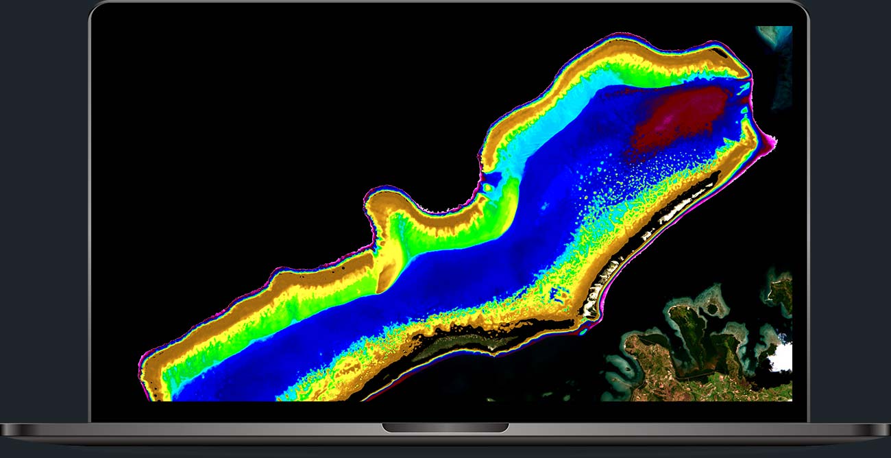
Knowing the seafloor has never been easier. With SDB-Online, EOMAP makes satellite bathymetry accessible directly from the browser, without complex tools. A key solution for coastal planning, safety, and marine environmental protection.
The need to accurately and continuously monitor seabeds is now central to the sustainable and effective management of coastal and marine areas. To meet this need, EOMAP offers Multisource Bathymetry (MSB): an integrated approach that combines high-resolution satellite data, direct surveys (such as sonar and LIDAR), and official nautical charts to create comprehensive, consistent, and harmonized bathymetric models. This method overcomes existing discontinuities between shallow and deep waters, providing a continuous and reliable representation of the underwater environment.
The need for a multisource model arises from both practical and scientific demands: shallow water zones are highly sensitive areas where human activities, coastal infrastructure, and vulnerable marine habitats concentrate. Additionally, numerical models used to simulate phenomena such as currents, storm surges, or floods require precise, homogeneous, and gap-free data. The intelligent integration of different sources maximizes the value of each, ensuring up-to-date, high-resolution, and extensive coverage. All this is made possible by SDB-Online, the web application developed by EOMAP, which allows users to request satellite bathymetry processing directly online, simply and immediately, without the need to install dedicated software or use complex equipment.
Through an intuitive interface, SDB-Online enables users to select the most suitable satellite images based on key quality criteria such as cloud cover, water turbidity, or solar reflections (sunglint), thus guaranteeing the reliability of the final result. Furthermore, it is possible to integrate external data from direct surveys — such as sonar or LIDAR — to obtain even more precise and consistent bathymetric models. Results can then be exported in various raster formats compatible with major GIS software, numerical simulation models, and hydrographic management systems, facilitating data integration into professional workflows across multiple sectors.
The processing is based on Watcor-X, EOMAP’s proprietary calculation engine, which applies sophisticated physical light propagation models to accurately estimate depths from satellite spectral data. This solution targets professionals in coastal planning, environmental modeling, port management, civil protection, and marine conservation, providing a practical and effective tool for more informed, timely, and sustainable coastal zone management.
What is EOMAP?
EOMAP is part of the Fugro group, a world leader in geospatial and engineering solutions. Founded in 2006, it is a company specialized in observing and analyzing the aquatic environment using satellite data and advanced remote sensing technologies. It provides services and software for mapping seabeds in seas, lakes, and rivers (bathymetry), monitoring water quality, and other environmental analyses.
Source: https://eomap.com
