Il Digital Twin sta modificando profondamente le esigenze legate al rilievo aereo: alla precisione geometrica si affianca una crescente richiesta di informazioni tematiche capaci di descrivere materiali, vegetazione, temperature e fenomeni ambientali.
Il rilievo aereo non serve più soltanto a ottenere una rappresentazione geometrica accurata del territorio o della città. Alle informazioni 2D e 3D si affianca oggi una domanda crescente di dati capaci di descrivere caratteristiche e fenomeni che la sola geometria non può rappresentare.
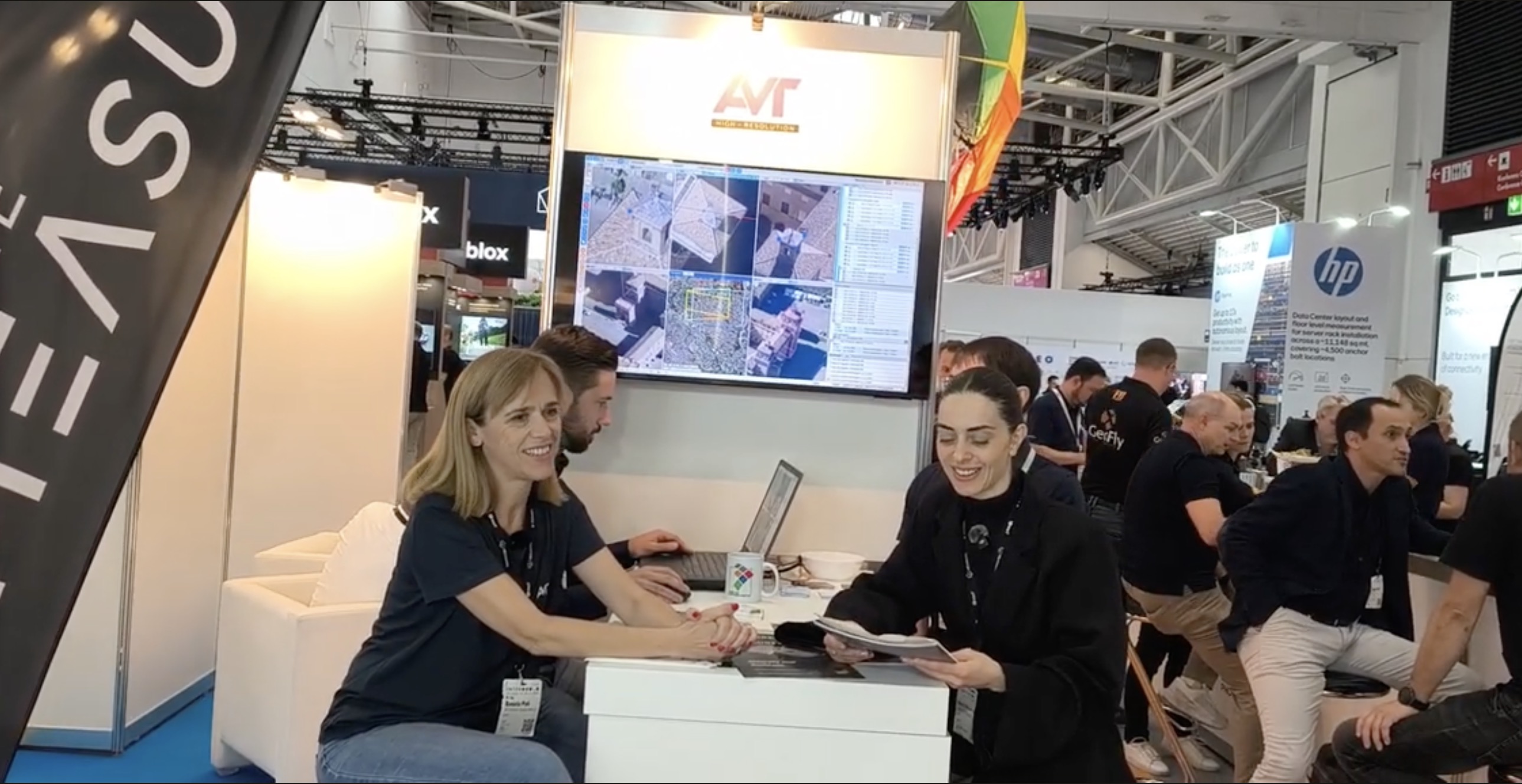
A INTERGEO 2026 GEOmedia ha incontrato Daniela Poli di AVT Airborne Sensing Italia per parlare dell'evoluzione dei sistemi di acquisizione, delle applicazioni delle camere termiche e iperspettrali, della fotogrammetria da immagini oblique e del ruolo che queste informazioni possono assumere nella realizzazione dei Digital Twin urbani.
Maria Chiara Spiezia, GEOmedia: Buongiorno da INTERGEO 2026. Sono Maria Chiara della redazione di GEOmedia e siamo in compagnia di Daniela Poli di AVT Airborne Sensing Italia. Daniela, benvenuta. Raccontaci brevemente chi è AVT.
Daniela Poli, AVT: Grazie, Chiara. AVT Airborne Sensing è un'azienda che esegue rilievi aerei in tutta Europa. Abbiamo una sede in Germania, dove sono basati gli aerei, una sede in Austria e una sede in Italia, a Trento, dove lavoro io. Eseguiamo rilievi aerei utilizzando diverse tipologie di sensori: camere fotogrammetriche, sensori LiDAR, camere iperspettrali e camere termiche. Ci occupiamo dell'intera filiera, dall'acquisizione dei dati fino alla produzione di prodotti 2D e 3D destinati ai clienti finali.
GEOmedia: Grazie per questa panoramica. Entriamo più nel dettaglio della vostra attività. Qual è la principale novità che AVT porta a INTERGEO 2026?
Daniela Poli: Qui a INTERGEO abbiamo portato diverse novità. La prima riguarda una serie di prodotti ottenuti attraverso rilievi aerei effettuati con camere termiche e camere iperspettrali. Abbiamo realizzato, ad esempio, diversi progetti per lo studio della formazione delle isole di calore durante il periodo estivo, ma anche per la mappatura dei materiali superficiali e per l'analisi dello stato di salute delle foreste e del verde urbano.
Una seconda novità che presentiamo qui con i miei colleghi è il software Measuree, un software fotogrammetrico sviluppato da AVT per la restituzione fotogrammetrica delle immagini aeree nadirali e oblique. Negli ultimi anni vediamo che sempre più Pubbliche Amministrazioni richiedono rilievi aerei obliqui. Mancava però uno strumento che ci permettesse di eseguire direttamente delle misure all'interno delle immagini oblique. Per questo motivo abbiamo sviluppato il software, che oggi utilizziamo sia per i nostri progetti sia per i nostri clienti.
GEOmedia: Digital Twin e 3D stanno cambiando i prodotti e i servizi richiesti dai clienti?
Daniela Poli: Sì. In generale, lavorando alla produzione di dati destinati ai Digital Twin, abbiamo visto i nostri clienti diventare sempre più esigenti. I prodotti 2D e 3D che offriamo rappresentano la base sulla quale vengono costruiti i Digital Twin. Di conseguenza, una base più accurata e più completa permette di realizzare Digital Twin a loro volta più completi. Dal punto di vista geometrico, nella nostra esperienza vengono richieste immagini con risoluzioni a terra sempre più elevate. Parliamo di cinque centimetri, ma arriviamo anche a risoluzioni di due o tre centimetri.
C'è poi l'aspetto tematico.
Vediamo che i clienti non si fermano più alla sola ricostruzione 3D di una città o di un ambiente urbano, ma richiedono ulteriori informazioni tematiche che, nel nostro caso, possono provenire ad esempio dalle camere iperspettrali o dalle altre camere aeree.
GEOmedia: Quindi un'informazione differente, perché più completa.
GEOmedia: Quale progetto vi ha dato maggiore soddisfazione quest'anno? INTERGEO è anche una buona occasione per raccontare uno dei progetti che vi ha maggiormente colpito.
Daniela Poli: Direi molti progetti, soprattutto quelli legati all'utilizzo di nuove tecnologie, come le camere termiche o iperspettrali. Personalmente, però, sono rimasta particolarmente colpita dal progetto di Vienna, dove a partire da un volo obliquo siamo riusciti a estrarre informazioni metriche raggiungendo un livello di accuratezza davvero elevato, anche grazie al software Measuree.
Probabilmente, quindi, sceglierei il progetto di Vienna.
GEOmedia: Un'esperienza sicuramente interessante anche perché può essere replicata in altre città europee e, naturalmente, anche nelle città italiane.
GEOmedia: Visto che siamo con la redazione di GEOmedia, puoi anticiparci brevemente i contenuti del prossimo articolo sulle isole di calore che state preparando per la rivista?
Daniela Poli: L'articolo riguarda un'applicazione che considero molto interessante e soprattutto molto utile. Abbiamo osservato come le temperature, soprattutto durante i mesi estivi, stiano aumentando e come le città debbano prepararsi, pensando anche all'implementazione di soluzioni in grado di mitigare questi cambiamenti.
Per una Pubblica Amministrazione, però, è innanzitutto molto importante conoscere dove si formano le isole di calore e perché si sviluppano in determinate aree piuttosto che in altre zone della città.
È proprio in questo contesto che i voli termici, come quelli acquisiti da AVT, permettono di effettuare confronti e misurare le variazioni termiche. Generalmente utilizziamo una camera termica con un'impronta a terra ampia, in modo da poter effettuare il rilievo di un'intera città in tempi ridotti. Inoltre, realizziamo i voli sia di notte sia di giorno, così da poter confrontare le temperature rilevate durante la notte, senza l'influenza diretta del Sole, con quelle registrate durante il giorno, quando si verificano i picchi di calore.
GEOmedia: Grazie per questa anticipazione e grazie anche per questa intervista.
“Una base più accurata e più completa permette di realizzare Digital Twin a loro volta più completi.”
Dal modello geometrico alla conoscenza della città
L'esperienza raccontata da AVT evidenzia un cambiamento significativo nel modo in cui viene concepito il rilievo aereo. La produzione di ortofoto, modelli 3D e nuvole di punti continua a rappresentare una componente fondamentale del processo, ma le esigenze legate ai Digital Twin stanno progressivamente ampliando il concetto stesso di dato geospaziale. Non basta più rappresentare correttamente la geometria di un edificio o di una città. Sempre più spesso è necessario aggiungere informazioni in grado di descrivere materiali, stato della vegetazione, distribuzione delle temperature e fenomeni ambientali.
In questo scenario, fotogrammetria, LiDAR, camere termiche e sensori iperspettrali non devono necessariamente essere considerati strumenti alternativi. Possono diventare sorgenti complementari all'interno dello stesso ecosistema informativo. La crescente richiesta di immagini con risoluzioni al suolo di pochi centimetri mostra quanto la qualità geometrica continui a essere determinante. Ma l'evoluzione descritta da Poli indica che il valore del Digital Twin dipende sempre più anche dall'integrazione tra accuratezza geometrica e ricchezza tematica.
Il caso delle isole di calore urbane rende particolarmente evidente questo passaggio. Un modello tridimensionale descrive la forma della città; un rilievo termico aggiunge invece un ulteriore livello di conoscenza, mostrando come quella stessa città reagisce alle condizioni ambientali. Il confronto tra acquisizioni diurne e notturne permette inoltre di osservare le variazioni termiche delle superfici e di comprendere meglio la distribuzione spaziale del fenomeno. Per le Pubbliche Amministrazioni, il valore di queste informazioni sta proprio nella possibilità di conoscere prima di intervenire: individuare le aree interessate, analizzare le differenze all'interno della città e costruire una base informativa utile alle successive strategie di mitigazione.
Acquisire → Misurare → Integrare → Comprendere → Decidere
In questa evoluzione, il Digital Twin non è soltanto una copia tridimensionale della città. Può diventare un'infrastruttura informativa capace di rappresentarne le caratteristiche, osservarne i fenomeni e supportare decisioni più consapevoli sul territorio.
Dalla geometria alla conoscenza: il valore del Digital Twin cresce con la qualità e la varietà dei dati che lo alimentano.
INTERGEO 2026 · Airborne Sensing & Digital Twin
AVT Airborne Sensing Italia
Fotogrammetria · LiDAR · Imaging termico · Imaging iperspettrale · Digital Twin · Measuree
English version
From aerial surveying to the Digital Twin: geometry, thematic data and new applications for cities
Digital Twins are profoundly changing the requirements of aerial surveying: alongside geometric accuracy, there is a growing demand for thematic information capable of describing materials, vegetation, temperatures and environmental phenomena.
Aerial surveying is no longer used only to obtain an accurate geometric representation of the territory or the city. Alongside 2D and 3D information, there is now a growing demand for data capable of describing characteristics and phenomena that geometry alone cannot represent.
At INTERGEO 2026, GEOmedia met Daniela Poli of AVT Airborne Sensing Italia to discuss the evolution of acquisition systems, the applications of thermal and hyperspectral cameras, photogrammetry from oblique imagery and the role this information can play in the development of urban Digital Twins.
Maria Chiara Spiezia, GEOmedia: Good morning from INTERGEO 2026. I’m Maria Chiara from the GEOmedia editorial team, and we are here with Daniela Poli of AVT Airborne Sensing Italia. Daniela, welcome. Could you briefly introduce AVT?
Daniela Poli, AVT: Thank you, Chiara. AVT Airborne Sensing is a company that carries out aerial surveys across Europe. We have an office in Germany, where the aircraft are based, an office in Austria and an office in Italy, in Trento, where I work. We perform aerial surveys using different types of sensors: photogrammetric cameras, LiDAR sensors, hyperspectral cameras and thermal cameras. We manage the entire workflow, from data acquisition through to the production of 2D and 3D products for end clients.
GEOmedia: Thank you for this overview. Let’s go into more detail about your activities. What is the main innovation AVT is bringing to INTERGEO 2026?
Daniela Poli: Here at INTERGEO we have brought several new developments. The first concerns a series of products obtained through aerial surveys carried out with thermal cameras and hyperspectral cameras. For example, we have completed several projects studying the formation of urban heat islands during the summer period, as well as surface material mapping and analysis of the health of forests and urban vegetation.
A second innovation we are presenting here with my colleagues is Measuree, a photogrammetric software package developed by AVT for photogrammetric restitution from nadir and oblique aerial imagery. In recent years, we have seen more and more Public Administrations requesting oblique aerial surveys. However, there was a lack of a tool that allowed us to take measurements directly within oblique images. For this reason, we developed the software, which we now use both for our own projects and for our clients.
GEOmedia: Are Digital Twins and 3D changing the products and services requested by clients?
Daniela Poli: Yes. In general, through our work producing data for Digital Twins, we have seen our clients become increasingly demanding. The 2D and 3D products we provide represent the foundation on which Digital Twins are built. As a result, a more accurate and more complete base makes it possible to create Digital Twins that are themselves more complete.
From a geometric point of view, in our experience clients are requesting imagery with increasingly high ground resolutions. We are talking about five centimetres, but we also reach resolutions of two or three centimetres.
Then there is the thematic aspect.
We see that clients are no longer satisfied with the 3D reconstruction of a city or an urban environment alone. They increasingly require additional thematic information which, in our case, can come for example from hyperspectral cameras or other airborne sensors.
GEOmedia: So, a different kind of information, because it is more complete.
GEOmedia: Which project gave you the greatest satisfaction this year? INTERGEO is also a good opportunity to talk about one of the projects that impressed you most.
Daniela Poli: I would say many projects, especially those involving the use of new technologies such as thermal or hyperspectral cameras. Personally, however, I was particularly impressed by the Vienna project, where, starting from an oblique flight, we were able to extract metric information while achieving a very high level of accuracy, also thanks to the Measuree software.
So I would probably choose the Vienna project.
GEOmedia: Certainly an interesting experience, also because it can be replicated in other European cities and, of course, in Italian cities as well.
GEOmedia: Since we are here with the GEOmedia editorial team, can you briefly give us a preview of the next article on urban heat islands that you are preparing for the magazine?
Daniela Poli: The article concerns an application that I consider very interesting and, above all, very useful. We have observed how temperatures, especially during the summer months, are increasing and how cities need to prepare, also by considering the implementation of solutions capable of mitigating these changes.
For a Public Administration, however, it is first of all very important to understand where heat islands form and why they develop in certain areas rather than in other parts of the city.
It is precisely in this context that thermal flights, such as those acquired by AVT, make it possible to carry out comparisons and measure thermal variations. We generally use a thermal camera with a wide ground footprint, so that an entire city can be surveyed in a relatively short time.
In addition, we conduct flights both at night and during the day, allowing us to compare temperatures recorded at night, without the direct influence of the Sun, with those measured during the day, when heat peaks occur.
GEOmedia: Thank you for this preview, and thank you for the interview.
“A more accurate and more complete base makes it possible to create Digital Twins that are themselves more complete.”
From the geometric model to knowledge of the city
The experience described by AVT highlights a significant change in the way aerial surveying is conceived. The production of orthophotos, 3D models and point clouds continues to represent a fundamental part of the process, but the requirements associated with Digital Twins are progressively broadening the very concept of geospatial data.
It is no longer enough to represent the geometry of a building or a city correctly. Increasingly, it is necessary to add information capable of describing materials, vegetation condition, temperature distribution and environmental phenomena.
In this scenario, photogrammetry, LiDAR, thermal cameras and hyperspectral sensors do not necessarily need to be considered alternative tools. They can become complementary sources within the same information ecosystem.
The growing demand for imagery with ground resolutions of only a few centimetres shows how geometric quality remains essential. But the evolution described by Poli indicates that the value of a Digital Twin increasingly depends on the integration of geometric accuracy and thematic richness.
The case of urban heat islands makes this transition particularly clear. A three-dimensional model describes the shape of the city; a thermal survey adds an additional layer of knowledge, showing how that same city responds to environmental conditions.
The comparison between daytime and night-time acquisitions also makes it possible to observe thermal variations across surfaces and better understand the spatial distribution of the phenomenon. For Public Administrations, the value of this information lies precisely in the ability to understand before intervening: identifying affected areas, analysing differences within the city and building an information base that can support subsequent mitigation strategies.
Acquire → Measure → Integrate → Understand → Decide
In this evolution, the Digital Twin is not simply a three-dimensional copy of the city. It can become an information infrastructure capable of representing its characteristics, observing its phenomena and supporting more informed decisions about the territory.
From geometry to knowledge: the value of the Digital Twin grows with the quality and variety of the data that feeds it.
INTERGEO 2026 · Airborne Sensing & Digital Twin
AVT Airborne Sensing Italia
Photogrammetry · LiDAR · Thermal imaging · Hyperspectral imaging · Digital Twin · Measuree