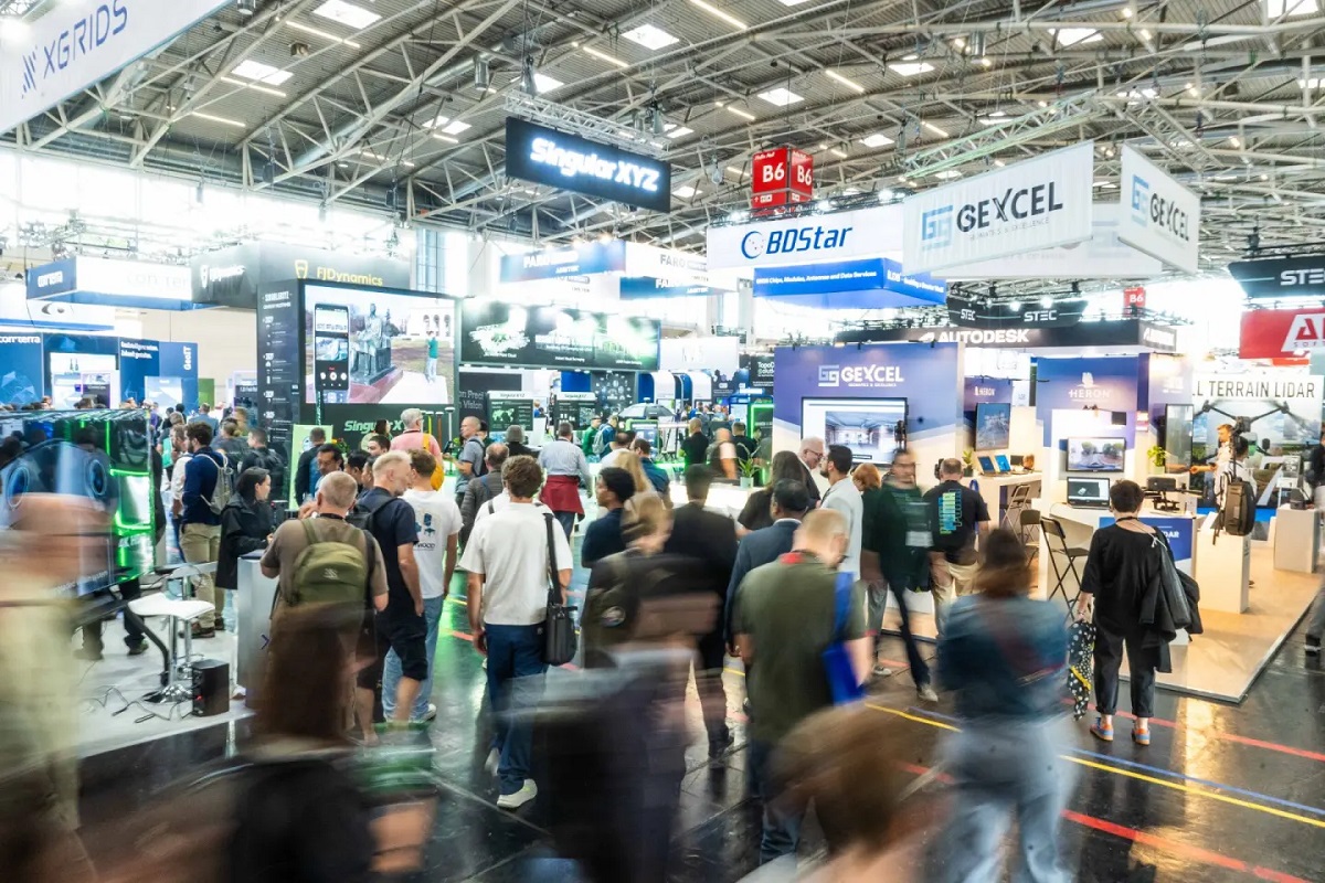
INTERGEO 2026, held in Munich from 15 to 17 September, highlighted a significant transformation in the geospatial industry: the transition from standalone technologies to increasingly integrated systems connecting data acquisition, processing, analysis and practical applications.
The event's figures confirmed its international reach, attracting more than 18,600 visitors from 121 countries, over 530 exhibitors from 44 countries and approximately 1,250 conference participants from 46 countries.
Beyond these figures, the exhibition and conference demonstrated how geospatial technologies are becoming essential components of digital transformation across infrastructure, urban planning, environmental management and public administration.
GeoAI and Digital Twins: Towards Connected Geospatial Workflows
Artificial intelligence was among the central themes of INTERGEO 2026, particularly its growing application to geospatial data processing, automated point cloud analysis and the interpretation of territorial and satellite information.
GeoAI is increasingly being incorporated into surveying, modelling and monitoring workflows, while digital twins are evolving towards dynamic representations of physical environments, continuously enriched by information from sensors, GIS platforms, BIM models and Earth Observation systems.
The integration of these technologies creates new opportunities for infrastructure lifecycle management, urban planning, environmental monitoring and risk assessment.
Interoperability emerged as a particularly important challenge. Connecting information from different sources while preserving accuracy, context and reliability is becoming essential for developing effective digital systems.
Reality Capture, Automation and Digital Infrastructure
Across the exhibition halls, innovations in reality capture demonstrated how sensors, software platforms, cloud services and artificial intelligence are converging into increasingly automated workflows.
The Reality Capturing Experience Parc provided practical demonstrations of the connection between physical environments and their digital representations, while the Real Estate Lab explored the growing relationship between geospatial technologies and the property sector.
Particular attention was given to the ability to capture, process and share three-dimensional information more efficiently, ensuring continuity between field operations, design activities and infrastructure management.
These developments reflect a broader industry trend towards integrated solutions that reduce the fragmentation of geospatial workflows and make spatial information more accessible to different professional communities.
INTERGEO Conference: GIS, Earth Intelligence and Emerging Expertise
Featuring more than 100 speakers, INTERGEO CONFERENCE 2026 addressed topics ranging from scientific innovation to practical applications in infrastructure, public administration, climate adaptation and urban development.
One of the main highlights was the keynote delivered by Jack Dangermond, Founder and President of Esri, entitled GIS – Creating a More Intelligent World.
His presentation emphasised the role of geographic information systems in understanding complex relationships and supporting informed decisions for a more sustainable and resilient future.
For the first time, the Conference Opening and keynote sessions were accessible to all INTERGEO ticket holders, encouraging closer interaction between conference participants and exhibition visitors.
The Frontiers of Geodetic Science (FroGS) initiative also provided an international platform for early-career researchers in geodesy.
Industry Perspectives: Trusted Data and Interoperability
Statements from INTERGEO's leading industry sponsors highlighted several shared priorities for the future of geospatial technologies.
Autodesk emphasised that the main challenge in infrastructure projects is not necessarily the volume of available data, but the ability to connect geospatial context, engineering information and project decisions.
Esri highlighted the concept of Earth Intelligence, combining geographic information, remote sensing and artificial intelligence to improve the understanding of complex territorial processes.
Hexagon and Leica Geosystems underlined the importance of reliable, accurate and precise geospatial information, particularly as automated systems increasingly depend on spatial data to support critical decisions.
Trimble pointed towards the development of connected and increasingly agentic workflows, enabling information to move seamlessly between field operations, office environments and different project phases.
Together, these perspectives indicate a common direction: the future value of geospatial technologies will increasingly depend on their ability to operate within interoperable, reliable and application-oriented digital ecosystems.
GEOmedia at INTERGEO 2026: Conversations with Industry Leaders
GEOmedia also attended INTERGEO 2026 in Munich, conducting interviews and meetings with international companies driving innovation across the geospatial sector.
The editorial activities carried out during the event explored developments in reality capture, GNSS technologies, GeoAI and digital twins, gathering industry perspectives on emerging solutions and their practical applications.
These contributions form part of GEOmedia's post-INTERGEO editorial programme, which examines technological developments and their impact on professional workflows and digital transformation.
Through interviews, technical insights and thematic articles, GEOmedia continues to connect international innovation with the needs and interests of the geospatial professional community.
Looking Ahead: INTERGEO 2027 in Frankfurt
The next edition of INTERGEO will take place in Frankfurt am Main from 12 to 14 October 2027.
The event will provide another opportunity to assess how the technologies showcased in Munich are evolving and, more importantly, how effectively they are being integrated into everyday geospatial workflows and digital infrastructure management.
Source: https://dvw.de/intergeo/en/press/intergeo-2026-physical-and-digital-worlds-converge